
Welcome! We are excited to fish with you this season! Below, you will find updated maps and directions to not only our facility, but also to the ports/docks where you will be fishing from. Please print these as you will so you are prepared for your trip. All departure times depend on daily tides. You will know your departure time when it is closer to your date.
Thank you and we look forward to seeing you!
~Cheers!
Ninilchik Fishing Maps/ Directions

From Anchorage Airport —> Ninilchik Charters Office
Once in Ninilchik, you will take a left onto Kingsley Dr and our facility is on the left .23 miles. Click the map above for detailed directions. Below is the map our the launch docks we use. Please call the number below for help with directions!
(Map will be provided to the docks once you visit our office!)
Homer Fishing Maps/ Directions

From Anchorage Airport —> The Homer Spit
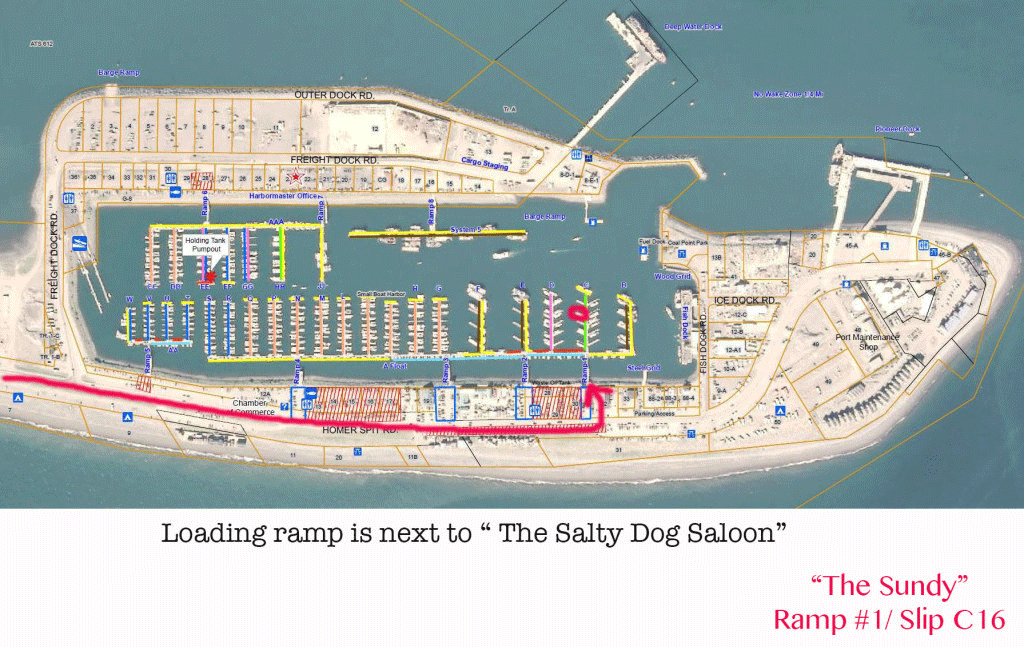
Once on the Homer Spit, you will continue to drive down to the end and you will see Salty Dog Saloon on your left. Park in that general area as our Dock is the the Right of the Saloon! Ramp #1/ Slip C16- ” The Sundy”. Please call the number below for help with directions!
Seward Fishing Maps/ Directions

From Anchorage Airport —> Seward Alaska
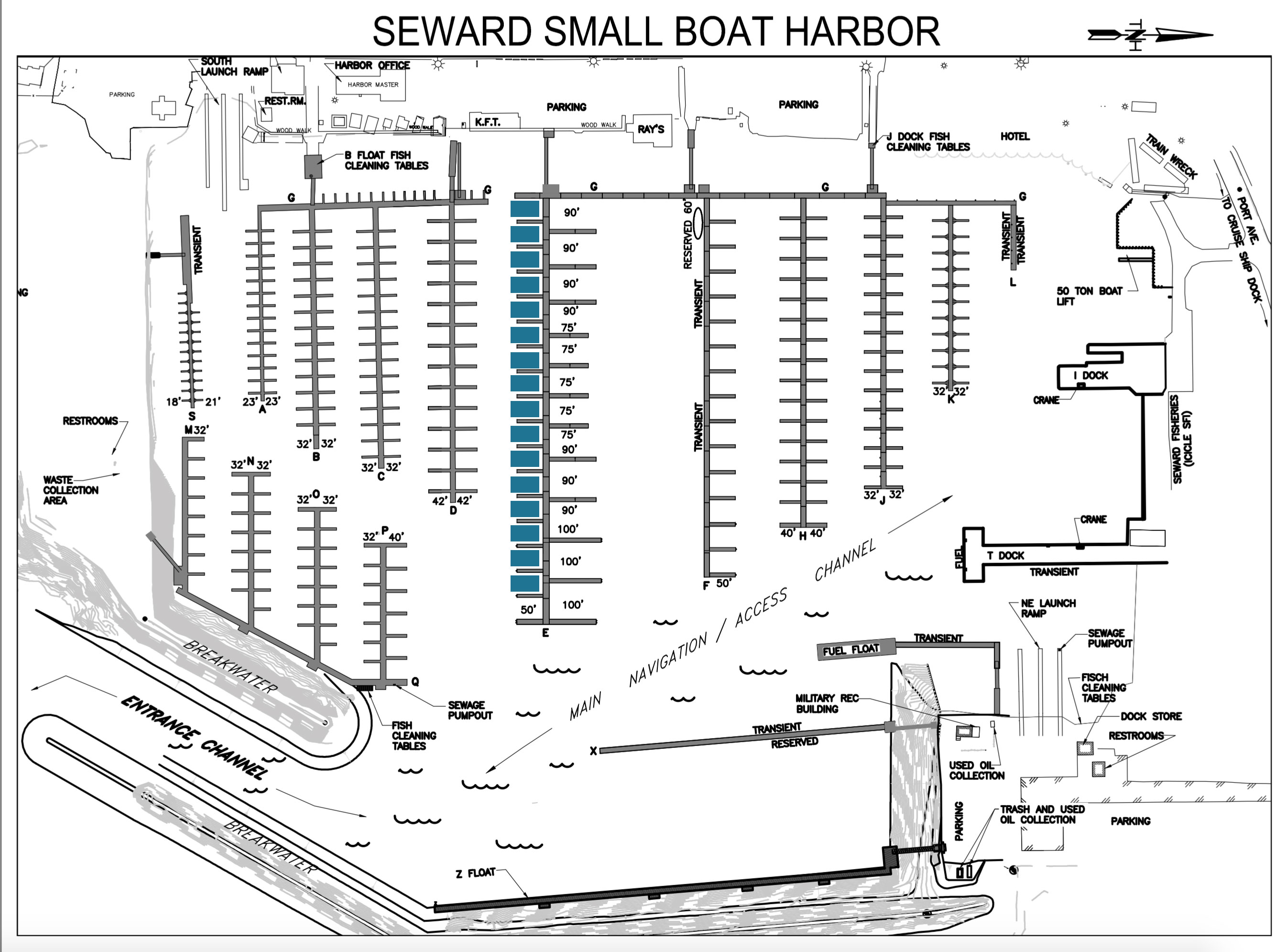
Once you get to Seward, you will continue driving down and the Small Boat docks will be on your left next to Heely Hasson Store. Park in the designated parking area and meet us at the boat! Review the map below for additional information. Ramp #5/ Slip E (slot to be determined)- ” The Arctic Endeavor”. Please call the number below for help with directions!
You can also view maps here http://www.cityofseward.net/harbor/seward_map.pdf
Kenai Fishing Maps/ Directions
Below you will find a general map for the Kenai Peninsula! We launch at both Stuart's Landing (power boat) and Centennial Park (drift boat) depending on which boat you are on. (click on map for larger version)

Kasilof Fishing Maps/ Directions
Whether you are fishing for Sockeyes or Kings, we meet at the State Park Bridge and will drive from there. Sockeye trips begin at the lake and we work our way down. King trips start at the river and work our way down.